Sea Surface Salinity
- HOME
- Research
- Topic
- Sea Surface Salinity
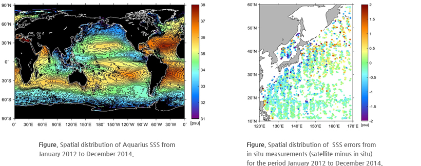
 Validation and Error Analysis of Satellite Sea Surface Salinity
Global maps of SSS were provided to show how oceans respond to climate change and the water cycle.
The links between the freshwater input and output to the ocean associated with precipitation, evaporation, ice melting, and river runoff were
investigated.
Monthly global space-based measurements of SSS with high accuracy (0.2 psu rms on 150×50 km scale over ice free oceans) were made.
An error analysis was conducted between the satellite SSS data and the in situ measurement of SSS in the northwest Pacific Ocean to validate use of the
satellite data.


