Sea Surface Height
- HOME
- Research
- Topic
- Sea Surface Height
 Sea Surface Height
Consecutive satellite altimeter missions such as ERS-1/2, TOPEX/Poseidon, Envisat, Jason-1/2, and SARAL/AltiKa have provided the global sea surface
height data for over 20 years.
An altimeter was used for sea surface height retrieval. A satellite altimeter measures the time taken by a radar pulse to travel from the satellite antenna
to the surface and back to the satellite receiver. Combined with precise satellite location data and atmospheric (ionosphere and troposphere (wet/dry))
and geophysical (tide, inverse barometer effect, sea state, etc.) correction data, altimeter measurements give sea surface heights.
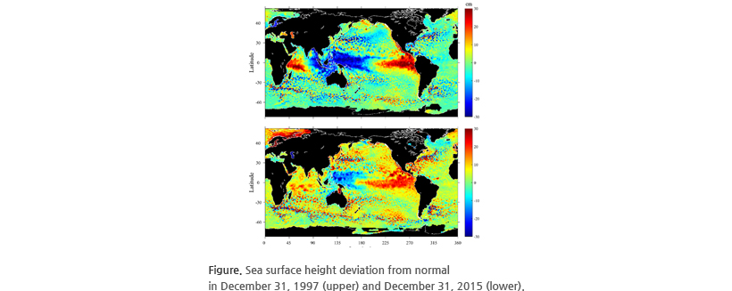
Satellite altimeter can monitor the global climatological phenomenon. During an El Nino, sea surface height is higher than normal sea surface height
in the east, and lower than normal sea surface height in the west. Altimeter data are vital for the early detection, analysis and close monitoring of
large-scale tropical climate anomalies, in order to predict when and how events will develop and, ultimately, to anticipate and mitigate their impacts.
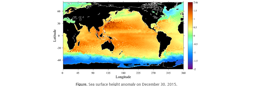
El Nino in 2015 was observed. Unusually high sea surface heights are shown along the equator in the central and eastern Pacific. Although the sea surface
height signal in December 1997 was more intense (upper), in December 2015, the area of the high sea levels was larger (lower).


